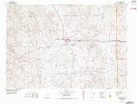
1972 Map of Gillette
USGS Topo · Published 1975About this map
Gillette serves as the focal point of this 1970s landscape, positioned as a growing industrial hub at the intersection of Interstate 90 and the Burlington Northern railroad. The map documents an era of significant energy development in Campbell County, clearly delineating the Wyodak Strip Mines and expansive petroleum operations such as the Kitty Oil and Gas Field and Dead Horse Creek Oil Field.
Find a feature on this map
72 named features on this map. Tap any name to fly to it.
Don’t see what you’re looking for? This feature index may not catch every label — zoom into the map to look around manually.
Map Details
Editions of this 1972 Gillette Map
This is the sole edition of this map. No revisions or reprints were ever made.
Other maps of this area

1905 · Devils Tower
USGS Topo · 1:125,000

1918 · Moorcroft
USGS Topo · 1:125,000

1918 · Moorcroft
USGS Topo · 1:62,500

1953 · Fats Draw
USGS Topo · 1:24,000

1953 · The Nipple
USGS Topo · 1:24,000

1954 · Gillette
USGS Topo · 1:250,000

1955 · Newcastle
USGS Topo · 1:250,000

1955 · Sheridan
USGS Topo · 1:250,000

1955 · Arminto
USGS Topo · 1:250,000

1955 · Gillette
USGS Topo · 1:250,000