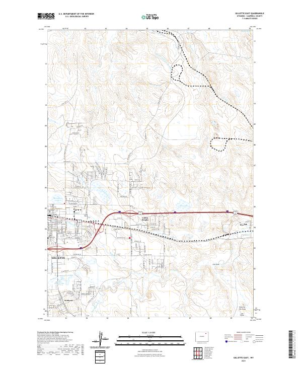
2021 Map of Gillette East
USGS Topo · Published 2021About this map
Gillette serves as the focal point of this Eastern Campbell County landscape, where the transition from residential grid systems to the industrial and natural draws of the high plains is clearly defined. The eastern expansion of the city is evident through neighborhoods like Collins Heights and the smaller settlement of Sunburst. To the east, Wyodak marks a significant industrial presence, while the terrain is etched by drainage networks including Donkey Creek, Little Rawhide Creek, and Stonepile Cr.
Find a feature on this map
66 named features on this map. Tap any name to fly to it.
Don’t see what you’re looking for? This feature index may not catch every label — zoom into the map to look around manually.
Map Details
Editions of this 2021 Gillette East Map
This is the sole edition of this map. No revisions or reprints were ever made.
Other maps of this area

1954 · Gillette
USGS Topo · 1:250,000

1955 · Gillette
USGS Topo · 1:250,000

1958 · Gillette
USGS Topo · 1:250,000

1962 · Gillette
USGS Topo · 1:250,000

1971 · Coyote Draw
USGS Topo · 1:24,000

1971 · Gillette East
USGS Topo · 1:24,000

1971 · Green Hill
USGS Topo · 1:24,000
1971 · The Gap
USGS Topo · 1:24,000
1971 · Appel Butte
USGS Topo · 1:24,000
1971 · Gillette West
USGS Topo · 1:24,000