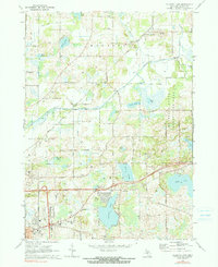
1970 Map of Gilletts Lake
USGS Topo · Published 1990About this map
The State Prison Farm dominates the central landscape of this Michigan survey, illustrating a large institutional footprint near the Portage River. In the southern reaches, the residential development of Cedar Knolls and various trailer parks sits adjacent to the recreational waters of Gilletts Lake and Goose Lake. This era shows a transition between traditional agriculture and growing suburban corridors, with educational hubs like East Jackson High Sch and the Clement Sch serving the local population.
Find a feature on this map
61 named features on this map. Tap any name to fly to it.
Don’t see what you’re looking for? This feature index may not catch every label — zoom into the map to look around manually.
Map Details
Editions of this 1970 Gilletts Lake Map
2 editions found
Other maps of this area

1919 · Stockbridge
USGS Topo · 1:62,500

1919 · Rives Junction
USGS Topo · 1:62,500

1921 · Rives Junction
USGS Topo · 1:62,500

1922 · Stockbridge
USGS Topo · 1:62,500

1935 · Jackson
USGS Topo · 1:48,000

1939 · Jackson
USGS Topo · 1:62,500

1942 · Stockbridge
USGS Topo · 1:62,500

1948 · Manchester
USGS Topo · 1:62,500

1949 · Manchester
USGS Topo · 1:62,500

1958 · Grand Rapids
USGS Topo · 1:250,000