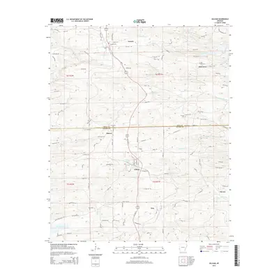
2014 Map of Gillham
USGS Topo · Published 2014About this map
The town of Gillham serves as the central hub of this Arkansas landscape, situated along the north-south corridor of US Highway 71 and the Kansas City Southern Railway. This modern topographic survey reveals the complex drainage systems of the Ouachita Mountains foothills, where Sycamore Cr and Almond Cr flow eastward through the town and the smaller community of King. To the north, the settlement of Grannis is marked by Grannis Cem and the nearby Aeration Lake. The map illustrates the border between Polk and Sevier counties, a boundary that bisects the rural landscape near Mineral. For genealogists and local historians, the inclusion of numerous remote burial sites, such as Overture Cem and Holly Grove Cem, provides specific coordinates for family research in an area dominated by timberlands and the upper reaches of Gillham Lake.
Find a feature on this map
115 named features on this map. Tap any name to fly to it.
Don’t see what you’re looking for? This feature index may not catch every label — zoom into the map to look around manually.
Map Details
Editions of this 2014 Gillham Map
This is the sole edition of this map. No revisions or reprints were ever made.
Other maps of this area
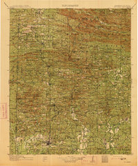
1913 · De Queen
USGS Topo · 1:125,000
1950 · Mcalester
USGS Topo · 1:250,000
1959 · Umpire
USGS Topo · 1:62,500
1959 · Cove
USGS Topo · 1:62,500
1962 · McAlester
USGS Topo · 1:250,000
1964 · Gillham Dam
USGS Topo · 1:24,000
1964 · Gillham
USGS Topo · 1:24,000
1965 · McAlester
USGS Topo · 1:250,000
1965 · Chapel Hill
USGS Topo · 1:24,000
1966 · De Queen
USGS Topo · 1:24,000