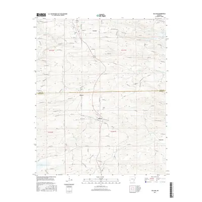
2017 Map of Gillham
USGS Topo · Published 2017About this map
Grannis and Gillham anchor this 2017 survey of the Arkansas timberlands along the Polk and Sevier county line. The landscape is defined by the high-relief drainage basins of the Rolling Fork and Coon Cr, punctuated by the major reservoirs of Gillham Lake in the northeast and the upper reaches of De Queen Lake in the southwest. The presence of numerous small cemeteries, such as Holly Grove Cem and Mineral Cem, provides a valuable resource for genealogists tracing local families across this rural Ouachita foothills region. Transportation is dominated by the north-south corridor of U.S. Route 71, which connects the smaller settlements of Mineral and Fairview through a dense network of timber access roads, including many Weyerhaeuser and Forest routes that facilitate the region's primary industry.
Find a feature on this map
92 named features on this map. Tap any name to fly to it.
Don’t see what you’re looking for? This feature index may not catch every label — zoom into the map to look around manually.
Map Details
Editions of this 2017 Gillham Map
This is the sole edition of this map. No revisions or reprints were ever made.
Other maps of this area

1913 · De Queen
USGS Topo · 1:125,000

1950 · Mcalester
USGS Topo · 1:250,000

1959 · Umpire
USGS Topo · 1:62,500

1959 · Cove
USGS Topo · 1:62,500

1962 · McAlester
USGS Topo · 1:250,000

1964 · Gillham Dam
USGS Topo · 1:24,000

1964 · Gillham
USGS Topo · 1:24,000

1965 · McAlester
USGS Topo · 1:250,000
1965 · Chapel Hill
USGS Topo · 1:24,000
1966 · De Queen
USGS Topo · 1:24,000