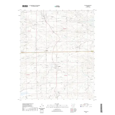
2020 Map of Gillham
USGS Topo · Published 2020About this map
Grannis and Gillham serve as the primary anchors for this 2020 study of the Arkansas interior, situated along the Polk Co Sevier Co line. The landscape is defined by the significant footprint of Gillham Lake and a dense network of watercourses including Coon Cr, Carters Creek, and Sycamore Cr. This map is particularly valuable for genealogical research, as it documents numerous small burial grounds dispersed across the townships, such as Holly Grove Cem, Overturf Cem, and Valley Cem. The infrastructure is characterized by an extensive system of timber and forest access routes, including Weyerhaeuser 80950 Rd and several designated Forest Rd segments, reflecting the region's managed woodland economy. Smaller settlements like Mineral and Fairview further illustrate the distribution of local communities in this timber-rich corner of the state.
Find a feature on this map
108 named features on this map. Tap any name to fly to it.
Don’t see what you’re looking for? This feature index may not catch every label — zoom into the map to look around manually.
Map Details
Editions of this 2020 Gillham Map
This is the sole edition of this map. No revisions or reprints were ever made.
Other maps of this area

1913 · De Queen
USGS Topo · 1:125,000

1950 · Mcalester
USGS Topo · 1:250,000

1959 · Umpire
USGS Topo · 1:62,500

1959 · Cove
USGS Topo · 1:62,500

1962 · McAlester
USGS Topo · 1:250,000

1964 · Gillham Dam
USGS Topo · 1:24,000

1964 · Gillham
USGS Topo · 1:24,000

1965 · McAlester
USGS Topo · 1:250,000
1965 · Chapel Hill
USGS Topo · 1:24,000
1966 · De Queen
USGS Topo · 1:24,000