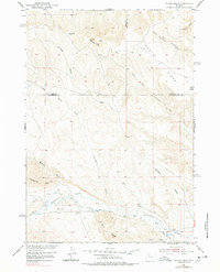
1951 Map of Gillies Draw
USGS Topo · Published 1978About this map
Squaw Teats and Sawtooth rise above the high desert floor where the borders of Park, Washakie, and Hot Springs counties converge. This 1951 survey, part of the Missouri River Basin development program, documents a drainage-carved landscape dominated by significant landforms like Hillberry Rim and Blue Ridge. The region is defined by its complex network of seasonal draws and creeks, including the central Gillies Draw and the more prominent Gooseberry Creek to the south.
Find a feature on this map
20 named features on this map. Tap any name to fly to it.
Don’t see what you’re looking for? This feature index may not catch every label — zoom into the map to look around manually.
Map Details
Editions of this 1951 Gillies Draw Map
2 editions found
Other maps of this area

1913 · Grass Creek Basin
USGS Topo · 1:62,500

1914 · Blue Mesa
USGS Topo · 1:62,500

1915 · Grass Creek Basin
USGS Topo · 1:62,500

1916 · Blue Mesa
USGS Topo · 1:62,500

1951 · Hillberry Rim
USGS Topo · 1:24,000

1951 · Dutch Nick Flat SW
USGS Topo · 1:24,000

1951 · Gillies Draw
USGS Topo · 1:24,000

1951 · Wilson Spring
USGS Topo · 1:24,000

1951 · Dead Indian Hill
USGS Topo · 1:24,000

1951 · Dutch Nick Flat NW
USGS Topo · 1:24,000