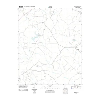
2011 Map of Gillsville
USGS Topo · Published 2011About this map
Gillsville serves as the primary hub in this Hall County landscape, situated at a junction of roads that traverse the rolling terrain of northern Georgia. The area is defined by the winding course of the North Oconee River and its numerous tributaries, such as Cedar Creek and Buffington Mill Creek. Evidence of early community life is preserved through several family and church burial grounds, including the Whitehall, Dunagans Chapel, and Diamond Hill Cemetery.
Find a feature on this map
85 named features on this map. Tap any name to fly to it.
Don’t see what you’re looking for? This feature index may not catch every label — zoom into the map to look around manually.
Map Details
Editions of this 2011 Gillsville Map
This is the sole edition of this map. No revisions or reprints were ever made.
Other maps of this area

1891 · Gainesville
USGS Topo · 1:125,000

1954 · Greenville
USGS Topo · 1:250,000

1958 · Greenville
USGS Topo · 1:250,000

1964 · Maysville
USGS Topo · 1:24,000

1964 · Chestnut Mountain
USGS Topo · 1:24,000

1964 · Lula
USGS Topo · 1:24,000

1964 · Gainesville
USGS Topo · 1:24,000

1964 · Pendergrass
USGS Topo · 1:24,000
1964 · Baldwin
USGS Topo · 1:24,000
1964 · Gillsville
USGS Topo · 1:24,000