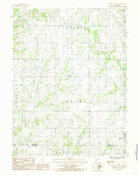
1984 Map of Gilman City West
USGS Topo · Published 1985About this map
Blue Ridge and the outskirts of Gilman City anchor this rural landscape in northern Missouri during the early 1980s. The terrain is defined by a dense network of drainages that carve through the townships of Sherman, Cypress, and Adams. The southern boundary of the map follows the Harrison Co Daviess Co line, illustrating the jurisdictional divide in this agricultural region. Numerous watercourses, including Polecat Creek, Sugar Creek, and Hickory Creek, create a dendritic pattern across the sheet, influencing the placement of local roads and farmsteads. The documentation of small settlements like Blue Ridge provides a look at the community centers that sustained the surrounding rural population. This survey captures the land before significant modern development, preserving the locations of rural school districts and family farms as they were established by the late twentieth century.
Find a feature on this map
17 named features on this map. Tap any name to fly to it.
Don’t see what you’re looking for? This feature index may not catch every label — zoom into the map to look around manually.
Map Details
Editions of this 1984 Gilman City West Map
This is the sole edition of this map. No revisions or reprints were ever made.
Other maps of this area

1925 · Pattonsburg
USGS Topo · 1:62,500

1925 · Gilman
USGS Topo · 1:62,500

1944 · Pattonsburg
USGS Topo · 1:62,500

1946 · Gilman
USGS Topo · 1:48,000

1946 · Pattonsburg
USGS Topo · 1:48,000

1947 · Blythedale
USGS Topo · 1:62,500

1948 · Gilman
USGS Topo · 1:62,500

1948 · Bethany
USGS Topo · 1:62,500

1948 · Pattonsburg
USGS Topo · 1:62,500

1954 · Centerville
USGS Topo · 1:250,000