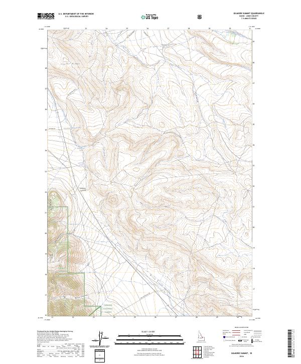
2024 Map of Gilmore Summit
USGS Topo · Published 2024About this map
Gilmore Summit serves as a high-altitude drainage divide within the Lemhi Range, marking a rugged intersection between the Salmon National Forest and the Targhee National Forest. This high pass orients the landscape between the Birch Creek Valley to the south and the northern drainage of Texas Creek. The terrain is characterized by a network of isolated water sources, including Allhands Spring, Slaughterhouse Spring, and Robertson Spring, which would have been vital points for early livestock transit and local travel.
Find a feature on this map
28 named features on this map. Tap any name to fly to it.
Don’t see what you’re looking for? This feature index may not catch every label — zoom into the map to look around manually.
Map Details
Editions of this 2024 Gilmore Summit Map
This is the sole edition of this map. No revisions or reprints were ever made.
Other maps of this area

1955 · Dubois
USGS Topo · 1:250,000

1956 · Leadore
USGS Topo · 1:62,500

1956 · Morrison Lake
USGS Topo · 1:62,500

1956 · Nicholia
USGS Topo · 1:62,500

1957 · Gilmore
USGS Topo · 1:62,500

1958 · Dubois
USGS Topo · 1:250,000

1980 · Leadore
USGS Topo · 1:100,000

1987 · Gilmore
USGS Topo · 1:24,000
1987 · Morrison Lake
USGS Topo · 1:24,000

1987 · Purcell Spring
USGS Topo · 1:24,000