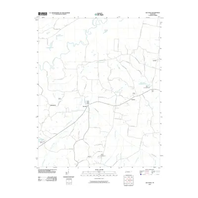
2010 Map of Gilt Edge
USGS Topo · Published 2010About this map
The Hatchie River winds through the northern portion of this Tipton County landscape, defining a terrain of oxbow lakes and bottomlands including Shingle Lake, Little Champion Lake, and Champion Lake. This western Tennessee region is characterized by small, established communities such as Gilt Edge, Garland, and Burlison, which are connected by a network of rural roads that often follow the natural contours of the land. The agricultural and residential character of the era is evident in the presence of the Giltedge Gin Rd and the Garland Post Office.
Find a feature on this map
66 named features on this map. Tap any name to fly to it.
Don’t see what you’re looking for? This feature index may not catch every label — zoom into the map to look around manually.
Map Details
Editions of this 2010 Gilt Edge Map
This is the sole edition of this map. No revisions or reprints were ever made.
Other maps of this area

1942 · Millington
USGS Topo · 1:62,500

1954 · Mason
USGS Topo · 1:62,500

1956 · Blytheville
USGS Topo · 1:250,000

1959 · Blytheville
USGS Topo · 1:250,000

1960 · Millington
USGS Topo · 1:62,500

1961 · Rialto
USGS Topo · 1:62,500

1962 · Rialto
USGS Topo · 1:62,500

1963 · Osceola
USGS Topo · 1:62,500

1965 · Osceola
USGS Topo · 1:62,500

1965 · Brighton
USGS Topo · 1:24,000