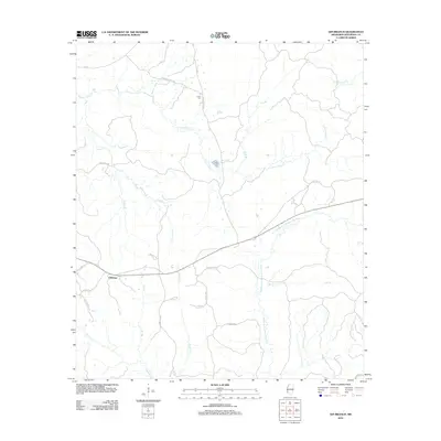
2012 Map of Gin Branch
USGS Topo · Published 2012About this map
Jefferson sits at a crossroads in the western portion of this landscape, where the headwaters of numerous creeks begin their descent toward the Mississippi River. The terrain is defined by a dense network of drainage systems, most notably the Middle Fork Homochitto River and N Fork Coles Cr, which carve through the countryside alongside smaller tributaries like Gin Br and Blue Goose Cr. This 2012 survey illustrates a predominantly rural environment where life is organized around a series of winding country roads such as Ephesus Church Rd and Chigger Ridge Rd. A solitary point of genealogical interest, the Dillon Cem, is found along Dennis Cross Rd, serving as a quiet anchor for local family history amidst the timber and farmland that characterize this part of Jefferson County.
Find a feature on this map
31 named features on this map. Tap any name to fly to it.
Don’t see what you’re looking for? This feature index may not catch every label — zoom into the map to look around manually.
Map Details
Editions of this 2012 Gin Branch Map
This is the sole edition of this map. No revisions or reprints were ever made.
Other maps of this area

1939 · Lorman
USGS Topo · 1:62,500

1953 · Natchez
USGS Topo · 1:250,000

1956 · Natchez
USGS Topo · 1:250,000

1958 · St. Joseph
USGS Topo · 1:62,500

1959 · Natchez
USGS Topo · 1:250,000

1962 · Fayette
USGS Topo · 1:62,500

1963 · Red Lick
USGS Topo · 1:24,000

1963 · Union Church
USGS Topo · 1:62,500

1963 · McBride
USGS Topo · 1:24,000
1984 · Natchez
USGS Topo · 1:100,000