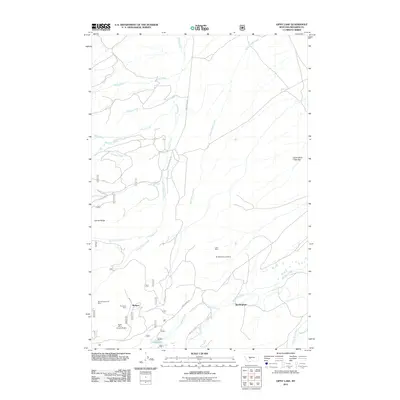
2011 Map of Gipsy Lake
USGS Topo · Published 2011About this map
Manger and Buckingham serve as central points in this landscape defined by high-country ranching and mining. Located within the Helena National Forest, the region shows a dense concentration of mineral activity, including the Porcupine Mine, Bigler Mine, and Snowbank Mine situated near the southwest corner of the sheet. Further north, the Lane Mine and SE NW Section 24 Mine indicate the spread of prospecting throughout the hills.
Find a feature on this map
28 named features on this map. Tap any name to fly to it.
Don’t see what you’re looking for? This feature index may not catch every label — zoom into the map to look around manually.
Map Details
Editions of this 2011 Gipsy Lake Map
This is the sole edition of this map. No revisions or reprints were ever made.
Other maps of this area

1886 · Fort Logan
USGS Topo · 1:250,000

1948 · White Sulphur Springs
USGS Topo · 1:250,000

1950 · Duck Creek Pass
USGS Topo · 1:62,500

1958 · White Sulphur Springs
USGS Topo · 1:250,000

1961 · White Sulphur Springs
USGS Topo · 1:250,000

1965 · White Sulphur Springs
USGS Topo · 1:250,000

1966 · Boulder Baldy
USGS Topo · 1:24,000

1966 · Watson
USGS Topo · 1:24,000
1971 · Whitetail Reservoir
USGS Topo · 1:24,000
1971 · Mount Edith
USGS Topo · 1:24,000