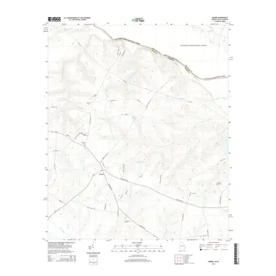
2014 Map of Girard
USGS Topo · Published 2014About this map
The town of Girard serves as a central hub in this corner of Burke County, where the landscape is defined by the winding Savannah River and the protected lands of the Savannah River National Forest. For genealogists, the area is notably dense with family-named burial sites and historic congregations, including Smith Chapel Cem, Heath Cem, Moody Cem, and Bethany Cem. These locations are scattered along old rural corridors like Brigham Landing Rd and Stoney Bluff Rd, which trace the higher ground between the numerous drainages that feed the river system. The hydrology is intricate, featuring many named branches and creeks such as Sweetwater Cr, Jenkins Br, and the Mash Pond area. To the south, Brier Creek and its associated wetlands like Mima Br frame the agricultural and wooded terrain, illustrating the traditional rural Georgia land patterns that persisted well into the twenty-first century.
Find a feature on this map
59 named features on this map. Tap any name to fly to it.
Don’t see what you’re looking for? This feature index may not catch every label — zoom into the map to look around manually.
Map Details
Editions of this 2014 Girard Map
This is the sole edition of this map. No revisions or reprints were ever made.
Other maps of this area

1920 · Ellenton
USGS Topo · 1:48,000

1920 · Hilltonia
USGS Topo · 1:62,500

1920 · Millen
USGS Topo · 1:62,500

1920 · Greens Cut
USGS Topo · 1:62,500

1921 · Ellenton
USGS Topo · 1:62,500

1943 · Hilltonia
USGS Topo · 1:62,500

1943 · Greens Cut
USGS Topo · 1:62,500

1943 · Millen
USGS Topo · 1:62,500

1943 · Augusta East
USGS Topo · 1:125,000

1943 · Millen
USGS Topo · 1:125,000