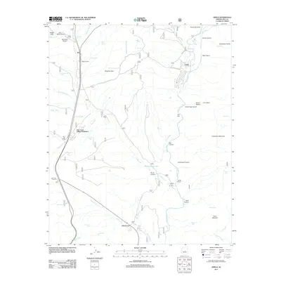
2011 Map of Gisela
USGS Topo · Published 2011About this map
Rye and Gisela serve as the primary hubs in this part of Gila County, where the landscape is defined by the drainage basins of Tonto Creek and Rye Creek. The map documents a blend of traditional ranching heritage and modern residential development, visible in the proximity of established operations like Seventy Six Ranch and H Bar Ranch to the Deer Creek Village Subdivision and Tonto Creek Shores. This area in central Arizona is deeply marked by its water sources, with numerous springs such as Sycamore Spring and Sand Wash Spring supporting life in the high desert terrain.
Find a feature on this map
66 named features on this map. Tap any name to fly to it.
Don’t see what you’re looking for? This feature index may not catch every label — zoom into the map to look around manually.
Map Details
Editions of this 2011 Gisela Map
This is the sole edition of this map. No revisions or reprints were ever made.
Other maps of this area

1887 · Verde
USGS Topo · 1:250,000

1892 · Verde
USGS Topo · 1:250,000

1907 · Roosevelt
USGS Topo · 1:125,000

1909 · Four Peaks
USGS Topo · 1:125,000

1912 · Roosevelt
USGS Topo · 1:125,000

1936 · Payson
USGS Topo · 1:48,000

1937 · Diamond Butte
USGS Topo · 1:48,000

1942 · Payson
USGS Topo · 1:62,500

1943 · Diamond Butte
USGS Topo · 1:62,500

1954 · Holbrook
USGS Topo · 1:250,000