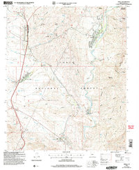
2004 Map of Gisela
USGS Topo · Published 2006About this map
Tonto Creek carves a central path through this section of the Tonto National Forest, where the transition from high mesa to deep canyon topography is clearly defined. The settlement of Gisela sits along the creek banks, while Deer Creek Village and Rye are situated further west near the highway corridor. This area showcases a landscape managed for cattle and conservation, dotted with numerous water features like Lower Barnhardt Tank and Black Mountain Tank, alongside established working spreads such as the Bar T Bar Ranch and Seventy Six Ranch.
Find a feature on this map
56 named features on this map. Tap any name to fly to it.
Don’t see what you’re looking for? This feature index may not catch every label — zoom into the map to look around manually.
Map Details
Editions of this 2004 Gisela Map
This is the sole edition of this map. No revisions or reprints were ever made.
Other maps of this area

1887 · Verde
USGS Topo · 1:250,000

1892 · Verde
USGS Topo · 1:250,000

1907 · Roosevelt
USGS Topo · 1:125,000

1909 · Four Peaks
USGS Topo · 1:125,000

1912 · Roosevelt
USGS Topo · 1:125,000

1936 · Payson
USGS Topo · 1:48,000

1937 · Diamond Butte
USGS Topo · 1:48,000

1942 · Payson
USGS Topo · 1:62,500

1943 · Diamond Butte
USGS Topo · 1:62,500

1954 · Holbrook
USGS Topo · 1:250,000