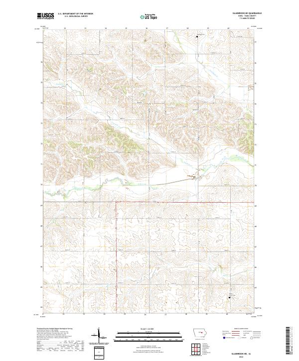
2022 Map of Gladbrook NE
USGS Topo · Published 2022About this map
The agrarian landscape of Tama County is defined by the winding course of Wolf Creek, which carves through the central portion of this area. The drainage pattern is further intricate, with Fourmile Cr, Twelvemile Cr, and Salt Cr weaving through the township boundaries of T86N and T85N. This survey documents the modern grid of rural roads, such as 190th St and Ridge Rd, which connect the scattered farmsteads and legacy sites of the region.
Find a feature on this map
23 named features on this map. Tap any name to fly to it.
Don’t see what you’re looking for? This feature index may not catch every label — zoom into the map to look around manually.
Map Details
Editions of this 2022 Gladbrook NE Map
This is the sole edition of this map. No revisions or reprints were ever made.
Other maps of this area

1954 · Waterloo
USGS Topo · 1:250,000

1955 · Waterloo
USGS Topo · 1:250,000

1963 · Buckingham
USGS Topo · 1:24,000

1971 · Gladbrook NE
USGS Topo · 1:24,000

1971 · Lincoln
USGS Topo · 1:24,000

1971 · Traer
USGS Topo · 1:24,000
1971 · Clutier
USGS Topo · 1:24,000

1971 · Reinbeck
USGS Topo · 1:24,000

1971 · Garwin
USGS Topo · 1:24,000
1971 · Gladbrook SE
USGS Topo · 1:24,000