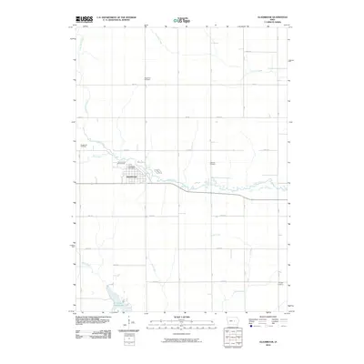
2010 Map of Gladbrook
USGS Topo · Published 2010About this map
Gladbrook serves as the central hub of this agricultural landscape in Tama County, situated at the confluence of several vital waterways including Wolf Creek and Devils Run. The town's civic identity is anchored by the Gladbrook Post Office and the Tama County Fairgrounds, which reflect the area's long-standing connection to Iowa's rural heritage. The surrounding countryside is defined by a rigorous section-line road grid, where a network of lettered and numbered avenues connects several family-linked burial grounds that speak to the generational history of the region.
Find a feature on this map
30 named features on this map. Tap any name to fly to it.
Don’t see what you’re looking for? This feature index may not catch every label — zoom into the map to look around manually.
Map Details
Editions of this 2010 Gladbrook Map
This is the sole edition of this map. No revisions or reprints were ever made.
Other maps of this area

1954 · Waterloo
USGS Topo · 1:250,000

1955 · Waterloo
USGS Topo · 1:250,000

1960 · Marshalltown
USGS Topo · 1:62,500

1960 · Le Grand
USGS Topo · 1:24,000

1960 · Conrad East
USGS Topo · 1:24,000

1971 · Gladbrook NE
USGS Topo · 1:24,000

1971 · Lincoln
USGS Topo · 1:24,000

1971 · Reinbeck
USGS Topo · 1:24,000

1971 · Garwin
USGS Topo · 1:24,000
1971 · Gladbrook SE
USGS Topo · 1:24,000