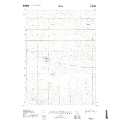
2018 Map of Gladbrook
USGS Topo · Published 2018About this map
Gladbrook serves as the central hub for this portion of Tama County, situated amidst a landscape defined by the drainage basins of Wolf Creek and its many tributaries. The area's agricultural heritage is reflected in the precise grid of section lines and rural roads, such as 180th St and 150th St, which connect dispersed farmsteads and numerous small family or community burial grounds. These sites, including Maple Hill Cem, Badger Hill Cem, and Gethman Cem, provide vital touchstones for local genealogy. In the southwest, the terrain transitions toward the recreation-focused area around Union Grove Lake and the adjacent Union Grove Cem. Waterways like Fourmile Cr, Crystal Cr, and Devils Run meander through the township, shaping the local topography and historical settlement patterns of the late 2010s.
Find a feature on this map
37 named features on this map. Tap any name to fly to it.
Don’t see what you’re looking for? This feature index may not catch every label — zoom into the map to look around manually.
Map Details
Editions of this 2018 Gladbrook Map
This is the sole edition of this map. No revisions or reprints were ever made.
Other maps of this area
1954 · Waterloo
USGS Topo · 1:250,000
1955 · Waterloo
USGS Topo · 1:250,000
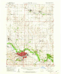
1960 · Marshalltown
USGS Topo · 1:62,500
1960 · Le Grand
USGS Topo · 1:24,000
1960 · Conrad East
USGS Topo · 1:24,000
1971 · Gladbrook NE
USGS Topo · 1:24,000
1971 · Lincoln
USGS Topo · 1:24,000
1971 · Reinbeck
USGS Topo · 1:24,000
1971 · Garwin
USGS Topo · 1:24,000
1971 · Gladbrook SE
USGS Topo · 1:24,000