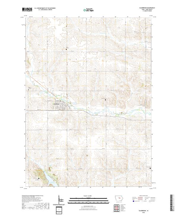
2022 Map of Gladbrook
USGS Topo · Published 2022About this map
The town of Gladbrook serves as the central hub of this Tama County landscape, situated where the Wolf Creek Trl follows the natural drainage of Wolf Creek. The surrounding agricultural terrain is deeply etched by a network of waterways including Devils Run, Fourmile Cr, and Pine Cr, all flowing through the townships of T86N R16W and T85N R16W. This area is characterized by its rural cemetery sites, which offer significant value for genealogical research, including Maple Hill Cem, Badger Hill Cem, and Gethman Cem. To the southwest, the environment shifts around Union Grove Lake, a notable water body surrounded by Union Grove Cem and the North Trl. The map reflects a classic Iowan grid of county roads, such as Co RD t47 and Co RD t55, which connect these dispersed rural landmarks and family burial grounds.
Find a feature on this map
49 named features on this map. Tap any name to fly to it.
Don’t see what you’re looking for? This feature index may not catch every label — zoom into the map to look around manually.
Map Details
Editions of this 2022 Gladbrook Map
This is the sole edition of this map. No revisions or reprints were ever made.
Other maps of this area

1954 · Waterloo
USGS Topo · 1:250,000

1955 · Waterloo
USGS Topo · 1:250,000

1960 · Marshalltown
USGS Topo · 1:62,500

1960 · Le Grand
USGS Topo · 1:24,000

1960 · Conrad East
USGS Topo · 1:24,000

1971 · Gladbrook NE
USGS Topo · 1:24,000

1971 · Lincoln
USGS Topo · 1:24,000

1971 · Reinbeck
USGS Topo · 1:24,000

1971 · Garwin
USGS Topo · 1:24,000
1971 · Gladbrook SE
USGS Topo · 1:24,000