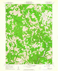
1960 Map of Gladesville
USGS Topo · Published 1961About this map
Halleck and Gladesville anchor this 1960 landscape where the borders of Monongalia, Preston, Taylor, and Marion counties meet. The map reveals a rural society structured around small communities, each defined by localized institutions such as Bethel Sch and Haymond Sch, alongside several rural congregations including Bethel Ch and South Point Ch. In the southern reaches, the Baltimore and Ohio railroad corridor follows the winding course of Three Fork Creek past Irontown and Hardman, serving as a critical artery for local transit and industry. Natural drainage patterns are clearly defined by the branching systems of Whiteday Creek and Glady Creek. Numerous family-named landmarks, such as Summers Cem and Kerns Cem, provide significant detail for genealogical research, while several Strip Mines in the northeast indicate the area's geological and economic activity.
Find a feature on this map
54 named features on this map. Tap any name to fly to it.
Don’t see what you’re looking for? This feature index may not catch every label — zoom into the map to look around manually.
Map Details
Editions of this 1960 Gladesville Map
4 editions found
Other maps of this area

1886 · St. George
USGS Topo · 1:125,000

1891 · St. George
USGS Topo · 1:125,000

1902 · Fairmont
USGS Topo · 1:62,500

1902 · Morgantown
USGS Topo · 1:62,500

1904 · Blacksville
USGS Topo · 1:62,500

1907 · Thornton
USGS Topo · 1:62,500

1923 · Blacksville
USGS Topo · 1:62,500

1923 · Fairmont
USGS Topo · 1:62,500

1925 · Blacksville
USGS Topo · 1:62,500

1925 · Morgantown
USGS Topo · 1:62,500