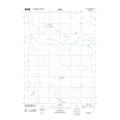
2011 Map of Gladstone
USGS Topo · Published 2011About this map
Powell and Gladstone serve as the primary nodes of settlement in this Jefferson County landscape, where the confluence of several vital waterways shaped the regional development. The Little Blue River and Big Sandy Creek meander across the terrain, supported by a network of water management features such as the Jefferson County Recreation Grounds Dam and the C E Rice Storage Dam. These reservoirs, including Alexandria Reservoir and Powell Reservoir, indicate a sophisticated system of water retention and recreation central to the area's agricultural and social life.
Find a feature on this map
36 named features on this map. Tap any name to fly to it.
Don’t see what you’re looking for? This feature index may not catch every label — zoom into the map to look around manually.
Map Details
Editions of this 2011 Gladstone Map
This is the sole edition of this map. No revisions or reprints were ever made.
Other maps of this area

1955 · Lincoln
USGS Topo · 1:250,000

1957 · Lincoln
USGS Topo · 1:250,000

1958 · Lincoln
USGS Topo · 1:250,000

1960 · Fairbury SW
USGS Topo · 1:24,000

1960 · Reynolds
USGS Topo · 1:24,000

1960 · Hubbell
USGS Topo · 1:24,000

1960 · Western SW
USGS Topo · 1:24,000

1960 · Fairbury
USGS Topo · 1:24,000

1960 · Tobias SW
USGS Topo · 1:24,000

1960 · Alexandria
USGS Topo · 1:24,000