
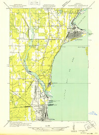
1932 Map of Gladstone SE
USGS Topo · Published 1932About this map
Industrial waterfronts and heavy rail infrastructure dominate this 1932 field survey of the Upper Peninsula shoreline. The city of Gladstone occupies a prominent position on Little Bay de Noc, where Elevator "C" and several rail spurs terminate at the water's edge. To the south, the Escanaba River is segmented by Dam 1, Dam 2, and Dam 3, providing power for local industry as it flows toward the expansive M St P & S Ste M Docks and C & NW Docks in North Escanaba.
Find a feature on this map
49 named features on this map. Tap any name to fly to it.
Don’t see what you’re looking for? This feature index may not catch every label — zoom into the map to look around manually.
Map Details
Editions of this 1932 Gladstone SE Map
2 editions found
Other maps of this area

1932 · Gladstone NE
USGS Topo · 1:31,680

1932 · Rapid River NW
USGS Topo · 1:31,680

1932 · Rapid River SW
USGS Topo · 1:31,680

1932 · Gladstone SW
USGS Topo · 1:31,680

1932 · Gladstone NW
USGS Topo · 1:31,680

1950 · Gladstone NW
USGS Topo · 1:31,680

1954 · Escanaba
USGS Topo · 1:250,000

1957 · Escanaba
USGS Topo · 1:250,000

1958 · Escanaba
USGS Topo · 1:250,000

1958 · Gladstone
USGS Topo · 1:62,500