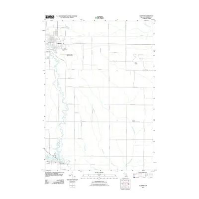
2011 Map of Gladwin
USGS Topo · Published 2011About this map
Gladwin and Beaverton anchor this central Michigan landscape, connected by the winding course of the Cedar River. The geography is defined by a dense network of river systems and creeks, including Venison Creek and Dow Creek, which converge as they flow toward Ross Lake. Significant local infrastructure is evident at the Gladwin County Fairgrounds and the Charles C Zettel Memorial Airport, while the industrial legacy of the region is marked by the North Buckeye Oil Field to the east. The rural sections of the county are partitioned by a strict grid of roads such as Hockaday Rd and Hawkins Rd, interspersed with quiet landmarks like Arbutus Cemetery and Highland Cemetery. This map provides a clear look at the spatial relationship between these two primary settlements and the waterways that historically shaped their development.
Find a feature on this map
60 named features on this map. Tap any name to fly to it.
Don’t see what you’re looking for? This feature index may not catch every label — zoom into the map to look around manually.
Map Details
Editions of this 2011 Gladwin Map
This is the sole edition of this map. No revisions or reprints were ever made.
Other maps of this area

1954 · Traverse City
USGS Topo · 1:250,000

1954 · Midland
USGS Topo · 1:250,000

1958 · Traverse City
USGS Topo · 1:250,000

1958 · Midland
USGS Topo · 1:250,000

1959 · Midland
USGS Topo · 1:250,000

1966 · Midland
USGS Topo · 1:250,000

1969 · Wagarville
USGS Topo · 1:24,000

1969 · Gladwin
USGS Topo · 1:24,000

1969 · Coleman
USGS Topo · 1:24,000
1969 · Skeels
USGS Topo · 1:24,000