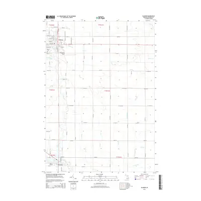
2014 Map of Gladwin
USGS Topo · Published 2014About this map
The Gladwin and Beaverton settlements anchor this landscape, where the Cedar River and Tobacco River converge in a complex web of agricultural and municipal drainage. In the north, the street grid of Gladwin is well-established, supported by the nearby Gladwin Zettel Memorial Airport and Highland Cem. The terrain is defined by its hydrography, featuring numerous named systems like the Canham Drain, Graham Drain, and Pete Drain that channel water through the township sections toward larger basins like Ross Lake in the south.
Find a feature on this map
59 named features on this map. Tap any name to fly to it.
Don’t see what you’re looking for? This feature index may not catch every label — zoom into the map to look around manually.
Map Details
Editions of this 2014 Gladwin Map
This is the sole edition of this map. No revisions or reprints were ever made.
Other maps of this area

1954 · Traverse City
USGS Topo · 1:250,000

1954 · Midland
USGS Topo · 1:250,000

1958 · Traverse City
USGS Topo · 1:250,000

1958 · Midland
USGS Topo · 1:250,000

1959 · Midland
USGS Topo · 1:250,000

1966 · Midland
USGS Topo · 1:250,000

1969 · Wagarville
USGS Topo · 1:24,000

1969 · Gladwin
USGS Topo · 1:24,000

1969 · Coleman
USGS Topo · 1:24,000
1969 · Skeels
USGS Topo · 1:24,000