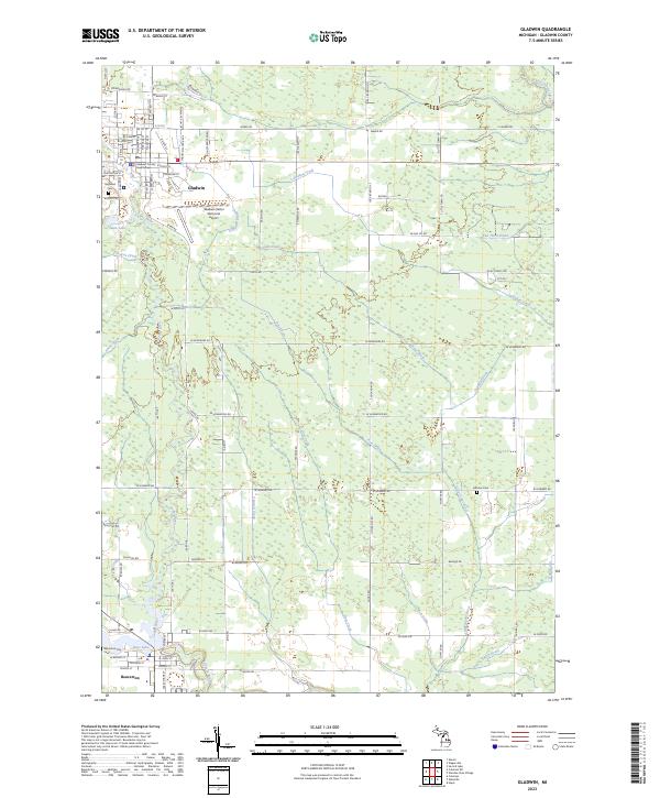
2023 Map of Gladwin
USGS Topo · Published 2023About this map
The Gladwin County Courthouse serves as the focal point for this region of Central Michigan, where the city of Gladwin and its southern neighbor Beaverton are linked by a complex network of waterways and county roads. The landscape is defined by the confluence of numerous tributaries, including the Cedar River and the Tobacco River, which feed into Ross Lake at Beaverton. This hydrology, featuring named drainage systems like the Van Horn Drain and Larrabee Creek, highlights a terrain historically managed for agriculture and timber. Rural landmarks such as the Highland Cem and Arbutus Cem are preserved alongside modern infrastructure like the Gladwin Zettel Memorial Airport. The map documents a structured grid of rural townships, where long-established family routes like Kerswill Rd and W Winegars Rd connect dispersed homesteads to the municipal centers.
Find a feature on this map
66 named features on this map. Tap any name to fly to it.
Don’t see what you’re looking for? This feature index may not catch every label — zoom into the map to look around manually.
Map Details
Editions of this 2023 Gladwin Map
This is the sole edition of this map. No revisions or reprints were ever made.
Other maps of this area

1954 · Traverse City
USGS Topo · 1:250,000

1954 · Midland
USGS Topo · 1:250,000

1958 · Traverse City
USGS Topo · 1:250,000

1958 · Midland
USGS Topo · 1:250,000

1959 · Midland
USGS Topo · 1:250,000

1966 · Midland
USGS Topo · 1:250,000

1969 · Wagarville
USGS Topo · 1:24,000

1969 · Gladwin
USGS Topo · 1:24,000

1969 · Coleman
USGS Topo · 1:24,000
1969 · Skeels
USGS Topo · 1:24,000