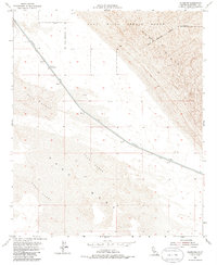
1954 Map of Glamis SE
USGS Topo · Published 1986About this map
The Coachella Canal cuts a distinct industrial path through the arid landscape of Imperial County, flanked by a protective Levee as it moves water through the desert. This mid-century survey captures a stark environment dominated by shifting topography, including the Sand Hills and the East Sand Dunes. Infrastructure is sparse in this corridor, limited to vital crossings like Coachella Bridge No 1. A significant portion of the northeastern quadrant is defined by military activity, marked by the Naval Reservation Boundary and the designated Sand Hills Impact Range. The mapping reflects a period of hydraulic engineering and military expansion in the California desert, where the engineered canal provides a sharp contrast to the natural expanse of the Mesa and surrounding Sand Dunes.
Find a feature on this map
10 named features on this map. Tap any name to fly to it.
Don’t see what you’re looking for? This feature index may not catch every label — zoom into the map to look around manually.
Map Details
Editions of this 1954 Glamis SE Map
3 editions found
Other maps of this area

1903 · Yuma
USGS Topo · 1:125,000

1905 · Yuma
USGS Topo · 1:125,000

1907 · Holtville
USGS Topo · 1:125,000

1942 · El Centro
USGS Topo · 1:250,000

1942 · Yuma
USGS Topo · 1:250,000

1953 · Grays Well
USGS Topo · 1:24,000

1953 · Ogilby
USGS Topo · 1:62,500

1953 · Cactus
USGS Topo · 1:24,000

1954 · El Centro
USGS Topo · 1:250,000

1954 · Midway Well NW
USGS Topo · 1:24,000