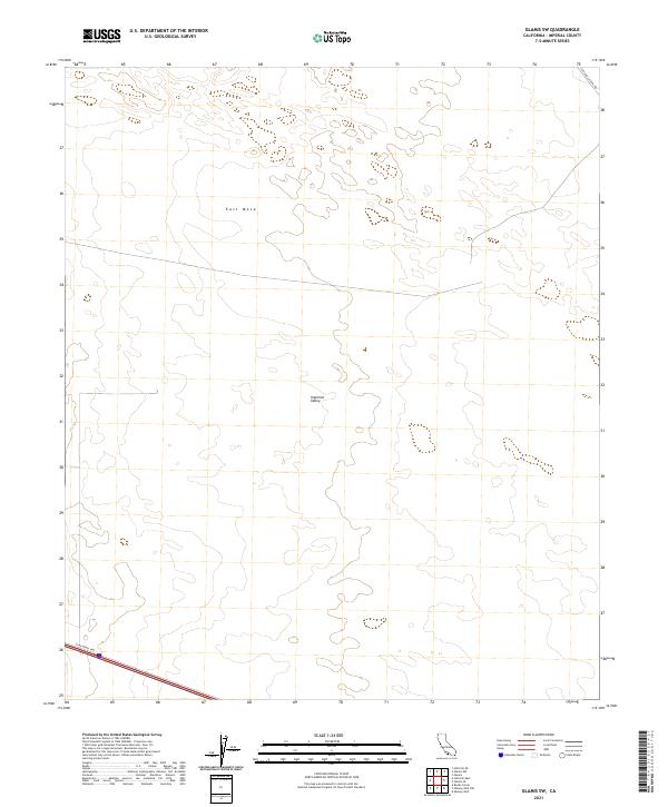
2021 Map of Glamis SW
USGS Topo · Published 2021About this map
The transition between the low-lying Imperial Valley and the slightly elevated desert landscape of East Mesa defines this part of Imperial County. Surveyed recently, the map illustrates a landscape shaped by both natural arid geography and significant infrastructure. In the southwest corner, the Evan Hewes Hwy cuts across the desert floor, providing a vital transportation link through the open terrain. To the northeast, Coachella Canal Rd runs along the map's boundary, tracing the path of essential water infrastructure in this drought-prone region. The map is largely structured by the Public Land Survey System, with township and range lines like t15s r17e and t16s r18e dividing the open space into a systematic grid of sections, typical of the managed lands in the California desert.
Find a feature on this map
8 named features on this map. Tap any name to fly to it.
Don’t see what you’re looking for? This feature index may not catch every label — zoom into the map to look around manually.
Map Details
Editions of this 2021 Glamis SW Map
This is the sole edition of this map. No revisions or reprints were ever made.
Other maps of this area

1907 · Holtville
USGS Topo · 1:125,000

1940 · Alamorio
USGS Topo · 1:62,500

1940 · Calexico
USGS Topo · 1:62,500

1942 · El Centro
USGS Topo · 1:250,000

1943 · Calexico
USGS Topo · 1:62,500

1945 · Alamorio
USGS Topo · 1:62,500
1953 · Calexico
USGS Topo · 1:50,000

1954 · El Centro
USGS Topo · 1:250,000

1954 · Midway Well NW
USGS Topo · 1:24,000
1954 · Glamis SE
USGS Topo · 1:24,000