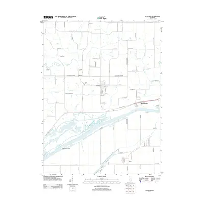
2012 Map of Glasford
USGS Topo · Published 2012About this map
The Illinois River corridor defines this portion of Peoria County, where the industrial presence of the Kingston River Terminal meets a landscape etched by backwater sloughs and agricultural tracts. In the early 21st century, the village of Glasford serves as a central hub for the surrounding rural sections, connected to smaller settlements like Lancaster and Kingston Mines by a grid of named county roads. The mapping reveals a distinct hydrological pattern where Dry Run and Peyton Cr drain toward the river's wide floodplain, which is punctuated by features such as Coon Hollow Island and Ferry Lake Slough. Local history is preserved through numerous family and community burial grounds, including Union Cem, Hinkle Cem, and Kingston Mines Cem, which are scattered among the ridges and creek valleys away from the river’s edge.
Find a feature on this map
97 named features on this map. Tap any name to fly to it.
Don’t see what you’re looking for? This feature index may not catch every label — zoom into the map to look around manually.
Map Details
Editions of this 2012 Glasford Map
This is the sole edition of this map. No revisions or reprints were ever made.
Other maps of this area

1905 · Peoria
USGS Topo · 1:62,500

1927 · Peoria
USGS Topo · 1:62,500

1929 · Manito
USGS Topo · 1:62,500

1930 · Glasford
USGS Topo · 1:62,500

1932 · Manito
USGS Topo · 1:62,500

1942 · Delavan
USGS Topo · 1:62,500

1948 · Glasford
USGS Topo · 1:62,500

1949 · Peoria West
USGS Topo · 1:24,000

1950 · Peoria West
USGS Topo · 1:24,000

1958 · Peoria
USGS Topo · 1:250,000