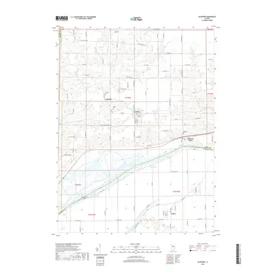
2018 Map of Glasford
USGS Topo · Published 2018About this map
Glasford serves as a central hub on this 2018 survey, positioned at the edge of the dissected uplands that drop toward the wide Illinois River valley. The map reveals the intricate drainage system of the region, where waterways like East Branch Copperas Creek, Little Lamarsh Cr, and Hinkle Br carve through the landscape. Near the river, the terrain flattens into a complex wetland environment characterized by Ferry Lake Slough, Brown Slough, and Redbird Slough, which weave around Coon Hollow Island.
Find a feature on this map
100 named features on this map. Tap any name to fly to it.
Don’t see what you’re looking for? This feature index may not catch every label — zoom into the map to look around manually.
Map Details
Editions of this 2018 Glasford Map
This is the sole edition of this map. No revisions or reprints were ever made.
Other maps of this area

1905 · Peoria
USGS Topo · 1:62,500

1927 · Peoria
USGS Topo · 1:62,500

1929 · Manito
USGS Topo · 1:62,500

1930 · Glasford
USGS Topo · 1:62,500

1932 · Manito
USGS Topo · 1:62,500

1942 · Delavan
USGS Topo · 1:62,500

1948 · Glasford
USGS Topo · 1:62,500

1949 · Peoria West
USGS Topo · 1:24,000

1950 · Peoria West
USGS Topo · 1:24,000

1958 · Peoria
USGS Topo · 1:250,000