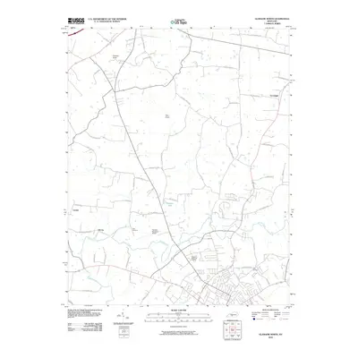
2010 Map of Glasgow North
USGS Topo · Published 2010About this map
Beaver Creek meanders through the heart of this Barren County landscape, anchoring a region defined by its traditional small-town settlements and prominent karst-country peaks. The map reveals the layout of rural communities such as Goodnight, Carden, and the uniquely named Oil City, which hint at the agricultural and early industrial foundations of the area. Significant local landmarks include the Glasgow Municipal Airport and the sprawling grounds of Glasgow Memorial Gardens. Elevated terrain is marked by notable high points such as Prewitts Knob and Flint Knob, which break the surrounding drainage patterns. Genealogists will find interest in the documented locations of Allen Cemetery and other family-named landmarks. The road network, featuring routes like Salem Church Rd and Old Munfordville Rd, connects these far-flung rural homesteads to the developing outskirts of the city.
Find a feature on this map
52 named features on this map. Tap any name to fly to it.
Don’t see what you’re looking for? This feature index may not catch every label — zoom into the map to look around manually.
Map Details
Editions of this 2010 Glasgow North Map
This is the sole edition of this map. No revisions or reprints were ever made.
Other maps of this area

1922 · Mammoth Cave
USGS Topo · 1:62,500

1923 · Mammoth Cave
USGS Topo · 1:62,500

1926 · Scottsville
USGS Topo · 1:62,500

1935 · Horse Cave
USGS Topo · 1:48,000

1938 · Horse Cave
USGS Topo · 1:62,500

1953 · Temple Hill
USGS Topo · 1:24,000

1953 · Glasgow South
USGS Topo · 1:24,000

1954 · Evansville
USGS Topo · 1:250,000

1954 · Park
USGS Topo · 1:24,000

1954 · Horse Cave
USGS Topo · 1:24,000