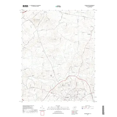
2019 Map of Glasgow North
USGS Topo · Published 2019About this map
The northern reaches of Glasgow and the surrounding Barren County countryside are defined by a complex network of county roads and distinctive geological features. Significant elevation markers like Prewitts Knob and Flint Knob rise above the landscape, while the headwaters of Beaver Creek and Little Beaver Creek drain the undulating terrain. This 2019 survey shows the transition from the city's suburban edge near Glasgow Municipal Airport to the agricultural outposts of Goodnight and Cave City. Family history and local landmarks are preserved in sites such as Allen Cem and Salem Church, illustrating the settled nature of these central Kentucky uplands. The prominence of legacy routes like Louisville Rd and Old Happy Valley Rd reveals how historic transit corridors continue to shape the regional development pattern between these established communities.
Find a feature on this map
116 named features on this map. Tap any name to fly to it.
Don’t see what you’re looking for? This feature index may not catch every label — zoom into the map to look around manually.
Map Details
Editions of this 2019 Glasgow North Map
This is the sole edition of this map. No revisions or reprints were ever made.
Other maps of this area

1922 · Mammoth Cave
USGS Topo · 1:62,500

1923 · Mammoth Cave
USGS Topo · 1:62,500

1926 · Scottsville
USGS Topo · 1:62,500

1935 · Horse Cave
USGS Topo · 1:48,000

1938 · Horse Cave
USGS Topo · 1:62,500

1953 · Temple Hill
USGS Topo · 1:24,000

1953 · Glasgow South
USGS Topo · 1:24,000

1954 · Evansville
USGS Topo · 1:250,000

1954 · Park
USGS Topo · 1:24,000

1954 · Horse Cave
USGS Topo · 1:24,000