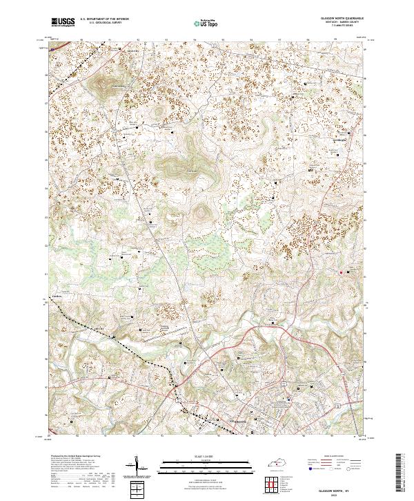
2022 Map of Glasgow North
USGS Topo · Published 2022About this map
Glasgow serves as the focal point for this section of Barren County, situated at the southern end of a landscape defined by its rolling karst topography and prominent high points like Prewitts Knob and Flint Knob. The map reveals a dense network of local roads and family-named cemeteries, reflecting generations of rural settlement. Clusters of these sites, such as the multiple Harlow Cem locations and the Caldwell Cem burials, suggest deep ancestral roots in the area. Transportation and public utility are central to the district, highlighted by the Glasgow Municipal Airport and the Southcentral Kentucky Community and Technical College Glasgow Health Campus. To the north, smaller settlements like Goodnight, Oil City, and Carden are connected by historical routes including Louisville Rd and Happy Valley Rd, while Poynters-Lake provides a significant water feature in this upland terrain.
Find a feature on this map
160 named features on this map. Tap any name to fly to it.
Don’t see what you’re looking for? This feature index may not catch every label — zoom into the map to look around manually.
Map Details
Editions of this 2022 Glasgow North Map
This is the sole edition of this map. No revisions or reprints were ever made.
Other maps of this area

1922 · Mammoth Cave
USGS Topo · 1:62,500

1923 · Mammoth Cave
USGS Topo · 1:62,500

1926 · Scottsville
USGS Topo · 1:62,500

1935 · Horse Cave
USGS Topo · 1:48,000

1938 · Horse Cave
USGS Topo · 1:62,500

1953 · Temple Hill
USGS Topo · 1:24,000

1953 · Glasgow South
USGS Topo · 1:24,000

1954 · Evansville
USGS Topo · 1:250,000

1954 · Park
USGS Topo · 1:24,000

1954 · Horse Cave
USGS Topo · 1:24,000