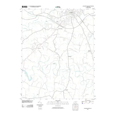
2010 Map of Glasgow South
USGS Topo · Published 2010About this map
The city of Glasgow anchors the northern edge of this Barren County landscape, where the Louie B Nunn-Cumberland Parkway and various state routes branch out through a series of rural communities. The map documents the transition from urban development to an agricultural and waterway-defined countryside, marked by smaller settlements like Pritchardsville, Haywood, and Bristletown. To the south, the terrain descends toward Roseville and the winding course of Skaggs Creek, which eventually feeds into the northern reaches of Barren River Lake. Numerous family and community landmarks are scattered throughout, including the Adams Cemetery, Allen Cemetery, and Barlow Cemetery, providing valuable points of reference for genealogical research. The waterway network is dense, with South Fork Beaver Creek, Boyds Creek, and Falling Timber Creek carving through the land, while the Morrisey Park Church Campground serves as a notable recreation site in the eastern portion of the quadrangle.
Find a feature on this map
58 named features on this map. Tap any name to fly to it.
Don’t see what you’re looking for? This feature index may not catch every label — zoom into the map to look around manually.
Map Details
Editions of this 2010 Glasgow South Map
This is the sole edition of this map. No revisions or reprints were ever made.
Other maps of this area

1922 · Mammoth Cave
USGS Topo · 1:62,500

1923 · Mammoth Cave
USGS Topo · 1:62,500

1926 · Scottsville
USGS Topo · 1:62,500

1935 · Horse Cave
USGS Topo · 1:48,000

1938 · Horse Cave
USGS Topo · 1:62,500

1953 · Tracy
USGS Topo · 1:24,000

1953 · Temple Hill
USGS Topo · 1:24,000

1953 · Glasgow South
USGS Topo · 1:24,000

1953 · Freedom
USGS Topo · 1:24,000

1954 · Evansville
USGS Topo · 1:250,000