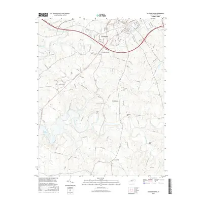
2016 Map of Glasgow South
USGS Topo · Published 2016About this map
Glasgow anchors this portion of Barren County, sitting at the junction of the Louie B Nunn-Cumberland Parkway and an intricate network of local roads. The landscape transition from the urbanized streets of the county seat to the rural southern reaches is defined by numerous watercourses, including the S Fork Beaver Cr and the winding Boyds Creek. Small unincorporated communities like Pritchardsville, Haywood, and Bristletown dot the map, serving as reminders of the area's agricultural hamlets.
Find a feature on this map
123 named features on this map. Tap any name to fly to it.
Don’t see what you’re looking for? This feature index may not catch every label — zoom into the map to look around manually.
Map Details
Editions of this 2016 Glasgow South Map
This is the sole edition of this map. No revisions or reprints were ever made.
Other maps of this area

1922 · Mammoth Cave
USGS Topo · 1:62,500

1923 · Mammoth Cave
USGS Topo · 1:62,500

1926 · Scottsville
USGS Topo · 1:62,500

1935 · Horse Cave
USGS Topo · 1:48,000

1938 · Horse Cave
USGS Topo · 1:62,500

1953 · Tracy
USGS Topo · 1:24,000

1953 · Temple Hill
USGS Topo · 1:24,000

1953 · Glasgow South
USGS Topo · 1:24,000

1953 · Freedom
USGS Topo · 1:24,000

1954 · Evansville
USGS Topo · 1:250,000