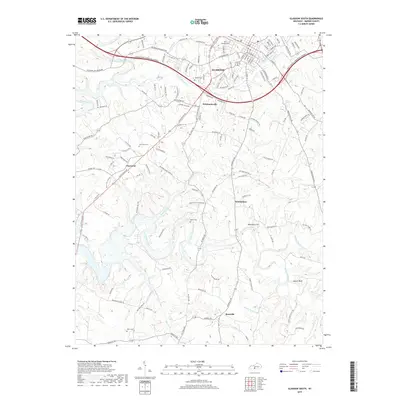
2019 Map of Glasgow South
USGS Topo · Published 2019About this map
Glasgow serves as the primary urban hub in this part of Barren County, where the Louie B Nunn-Cumberland Parkway and Old Bowling Green Rd facilitate regional movement. The landscape transitions from the developed streets of the city to a series of smaller rural communities and family-named landmarks. Several historic burial grounds, including Glasgow Cem, Barlow Cem, and Oak Grove Cem, are scattered throughout the countryside, providing essential points of reference for genealogical research. Southward, the terrain is defined by the winding paths of Beaver Creek and Skaggs Creek, which carve through the land near settlements like Bristletown and Roseville. This network of waterways and early road systems, such as Burkesville Rd and Tompkinsville Rd, illustrates the longstanding connection between topography and local settlement patterns in southern Kentucky.
Find a feature on this map
126 named features on this map. Tap any name to fly to it.
Don’t see what you’re looking for? This feature index may not catch every label — zoom into the map to look around manually.
Map Details
Editions of this 2019 Glasgow South Map
This is the sole edition of this map. No revisions or reprints were ever made.
Other maps of this area

1922 · Mammoth Cave
USGS Topo · 1:62,500

1923 · Mammoth Cave
USGS Topo · 1:62,500

1926 · Scottsville
USGS Topo · 1:62,500

1935 · Horse Cave
USGS Topo · 1:48,000

1938 · Horse Cave
USGS Topo · 1:62,500

1953 · Tracy
USGS Topo · 1:24,000

1953 · Temple Hill
USGS Topo · 1:24,000

1953 · Glasgow South
USGS Topo · 1:24,000

1953 · Freedom
USGS Topo · 1:24,000

1954 · Evansville
USGS Topo · 1:250,000