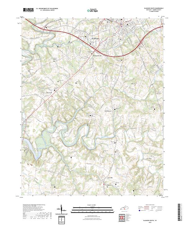
2022 Map of Glasgow South
USGS Topo · Published 2022About this map
The southern reaches of Glasgow anchor this Barren County landscape, where the Barren County Courthouse stands as a central civic landmark amidst a modern road network including the Cumberland Parkway and Veterans Outer Loop. Moving south into the rural interior, the terrain is defined by the winding paths of Beaver Creek and Skaggs Creek, which carve through a countryside dotted with small settlements like Pritchardsville, Bristletown, and Roseville.
Find a feature on this map
63 named features on this map. Tap any name to fly to it.
Don’t see what you’re looking for? This feature index may not catch every label — zoom into the map to look around manually.
Map Details
Editions of this 2022 Glasgow South Map
This is the sole edition of this map. No revisions or reprints were ever made.
Other maps of this area

1922 · Mammoth Cave
USGS Topo · 1:62,500

1923 · Mammoth Cave
USGS Topo · 1:62,500

1926 · Scottsville
USGS Topo · 1:62,500

1935 · Horse Cave
USGS Topo · 1:48,000

1938 · Horse Cave
USGS Topo · 1:62,500

1953 · Tracy
USGS Topo · 1:24,000

1953 · Temple Hill
USGS Topo · 1:24,000

1953 · Glasgow South
USGS Topo · 1:24,000

1953 · Freedom
USGS Topo · 1:24,000

1954 · Evansville
USGS Topo · 1:250,000