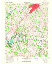
1965 Map of Glasgow South
USGS Topo · Published 1967About this map
The county seat of Glasgow dominates the northern edge of this survey, showing a concentrated urban footprint including the courthouse, Bunche High Sch, and Liberty Street Sch. The surrounding Barren County countryside is defined by an extensive network of petroleum extraction, with numerous Oil Wells and Gas Wells scattered throughout the rural landscape. In the south, the terrain becomes more complex as it approaches the U.S. Reservation Boundary and the winding waters of the Barren River Reservoir.
Find a feature on this map
40 named features on this map. Tap any name to fly to it.
Don’t see what you’re looking for? This feature index may not catch every label — zoom into the map to look around manually.
Map Details
Editions of this 1965 Glasgow South Map
This is the sole edition of this map. No revisions or reprints were ever made.
Other maps of this area

1922 · Mammoth Cave
USGS Topo · 1:62,500

1923 · Mammoth Cave
USGS Topo · 1:62,500

1926 · Scottsville
USGS Topo · 1:62,500

1935 · Horse Cave
USGS Topo · 1:48,000

1938 · Horse Cave
USGS Topo · 1:62,500

1953 · Tracy
USGS Topo · 1:24,000

1953 · Temple Hill
USGS Topo · 1:24,000

1953 · Glasgow South
USGS Topo · 1:24,000

1953 · Freedom
USGS Topo · 1:24,000

1954 · Evansville
USGS Topo · 1:250,000