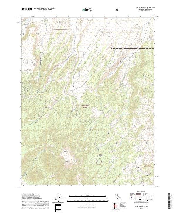
2021 Map of Glass Mountain
USGS Topo · Published 2021About this map
Glass Mtn and the high Glass Mtn Ridge dominate this high-altitude landscape within the Inyo National Forest. This 2021 survey details a complex system of drainage and seasonal water flow, where the Wet Fork and Dry Fork illustrate the hydrological variation of the California interior. The map reveals a land defined by its meadows, such as McGee Meadow, Sawmill Meadow, and Kelty Meadows, which serve as vital hubs for the local ecology and historical stock movement. Transportation is limited to rugged forest routes and established paths like the Kelty Stock Trl and 29e103 Trl, indicating the area's primary use for wilderness management and recreation rather than permanent settlement. The deep incisions of Sawmill Canyon and O'Harrel Canyon provide a clear view of the geological folding and erosion typical of this part of Mono County.
Find a feature on this map
30 named features on this map. Tap any name to fly to it.
Don’t see what you’re looking for? This feature index may not catch every label — zoom into the map to look around manually.
Map Details
Editions of this 2021 Glass Mountain Map
This is the sole edition of this map. No revisions or reprints were ever made.
Other maps of this area

1914 · Mt. Morrison
USGS Topo · 1:125,000

1947 · Mariposa
USGS Topo · 1:250,000

1948 · Mariposa
USGS Topo · 1:250,000

1953 · Mt. Morrison
USGS Topo · 1:62,500

1953 · Casa Diablo Mtn
USGS Topo · 1:62,500

1957 · Mariposa
USGS Topo · 1:250,000

1962 · Cowtrack Mtn
USGS Topo · 1:62,500

1962 · Glass Mountain
USGS Topo · 1:62,500

1963 · Mariposa
USGS Topo · 1:250,000
1983 · Whitmore Hot Sprs
USGS Topo · 1:24,000