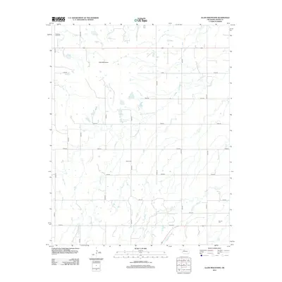
2012 Map of Glass Mountains
USGS Topo · Published 2012About this map
The Glass Mountains rise from the Major County landscape, defined by a complex network of seasonal drainages and rural crossroads. This 2012 survey shows a terrain carved by Cottonwood Cr, Elm Cr, and Gypsum Cr, which flow through a largely agricultural grid of section-line roads. The map provides significant detail for genealogists and local historians, anchoring the landscape with several established burial grounds including Cheyenne Valley Cem in the northwest and Roscoe Cem near the center of the quadrangle. Small water features like Edwards Lake and the Tck Twin Lakes Reservoir interrupt the arid plains. The road network, comprising numbered routes like n2490 RD and e0480 RD, highlights the enduring layout of Oklahoma's land survey system in the early 21st century.
Find a feature on this map
26 named features on this map. Tap any name to fly to it.
Don’t see what you’re looking for? This feature index may not catch every label — zoom into the map to look around manually.
Map Details
Editions of this 2012 Glass Mountains Map
This is the sole edition of this map. No revisions or reprints were ever made.
Other maps of this area

1955 · Woodward
USGS Topo · 1:250,000

1958 · Woodward
USGS Topo · 1:250,000

1969 · Glass Mountains NW
USGS Topo · 1:24,000

1969 · Glass Mountains
USGS Topo · 1:24,000

1969 · Fairview
USGS Topo · 1:24,000

1969 · Cleo Springs
USGS Topo · 1:24,000

1969 · Glass Mountains NE
USGS Topo · 1:24,000

1969 · Glass Mountains SW
USGS Topo · 1:24,000

1972 · Longdale
USGS Topo · 1:24,000

1972 · Canton NW
USGS Topo · 1:24,000