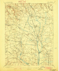
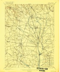
1898 Map of Glassboro
USGS Topo · Published 1902About this map
Glassboro stands as a central railroad hub in this late 19th-century survey of South Jersey, where the West Jersey And Seashore R. R. and Williamstown Branch intersect. The landscape is defined by a dense network of small agricultural settlements and station stops like Pitman, Richwood, and Aura that thrived alongside the rail lines. In the western portion of the quadrangle, the terrain is carved by the headwaters of Raccoon Creek and Oldmans Creek, while the eastern side features the extensive wetlands and winding course of the Maurice River. The map meticulously records the era's infrastructure, showing the transition from rural townships like Mantua and Washington to burgeoning rail towns. Notable local landmarks include the industrial footprint at Clayton and the crossroads at Mullica Hill, providing a detailed look at the region's development before modern suburban expansion.
Find a feature on this map
88 named features on this map. Tap any name to fly to it.
Don’t see what you’re looking for? This feature index may not catch every label — zoom into the map to look around manually.
Map Details
Editions of this 1898 Glassboro Map
6 editions found

Other maps of this area

1888 · Mount Holly
USGS Topo · 1:62,500

1890 · Hammonton
USGS Topo · 1:62,500

1890 · Salem
USGS Topo · 1:62,500

1890 · Tuckahoe
USGS Topo · 1:62,500

1890 · Bay Side
USGS Topo · 1:62,500

1890 · Bridgeton
USGS Topo · 1:62,500

1890 · Glassboro
USGS Topo · 1:62,500

1891 · Philadelphia
USGS Topo · 1:62,500

1893 · Tuckahoe
USGS Topo · 1:62,500

1894 · Bay Side
USGS Topo · 1:62,500