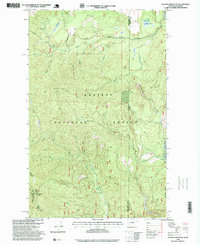
1996 Map of Gleason Mountain
USGS Topo · Published 1999About this map
The Kaniksu National Forest dominates this landscape along the high divide between Washington and Idaho. This 1990s revision of earlier surveys details a transition from the drainage of the Upper Priest River toward the rugged breaks of the Selkirk Mountains. The terrain is marked by significant hydrological features, including the dramatic Bath Creek Gorge and the cascading Kalispell Falls near the northern boundary.
Find a feature on this map
21 named features on this map. Tap any name to fly to it.
Don’t see what you’re looking for? This feature index may not catch every label — zoom into the map to look around manually.
Map Details
Editions of this 1996 Gleason Mountain Map
This is the sole edition of this map. No revisions or reprints were ever made.
Other maps of this area

1901 · Sandpoint
USGS Topo · 1:125,000

1911 · Priest Lake
USGS Topo · 1:250,000

1911 · Sandpoint
USGS Topo · 1:125,000

1913 · Priest Lake
USGS Topo · 1:250,000

1934 · Metaline
USGS Topo · 1:125,000

1936 · Newport
USGS Topo · 1:96,000

1942 · Metaline
USGS Topo · 1:125,000

1942 · Newport
USGS Topo · 1:125,000

1958 · Sandpoint
USGS Topo · 1:250,000

1963 · Sandpoint
USGS Topo · 1:250,000