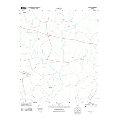
2011 Map of Glen Allen
USGS Topo · Published 2011About this map
The Sipsey River and the New River converge in this corner of Alabama, creating a landscape defined by the winding paths of Turkey Creek and Mallards Creek. Small rural settlements like Glen Allen, Bazemore, and Rock City dot the terrain, connected by a network of county roads such as Old Highway 78 and Eldridge Rd.
Find a feature on this map
79 named features on this map. Tap any name to fly to it.
Don’t see what you’re looking for? This feature index may not catch every label — zoom into the map to look around manually.
Map Details
Editions of this 2011 Glen Allen Map
This is the sole edition of this map. No revisions or reprints were ever made.
Other maps of this area

1953 · Birmingham
USGS Topo · 1:250,000

1956 · Birmingham
USGS Topo · 1:250,000

1956 · Gadsden
USGS Topo · 1:250,000

1957 · Birmingham
USGS Topo · 1:250,000

1958 · Gadsden
USGS Topo · 1:250,000

1958 · Gold Mine
USGS Topo · 1:24,000
1958 · Lynn
USGS Topo · 1:24,000

1960 · Gadsden
USGS Topo · 1:250,000

1963 · Gadsden
USGS Topo · 1:250,000

1967 · Winfield SE
USGS Topo · 1:24,000