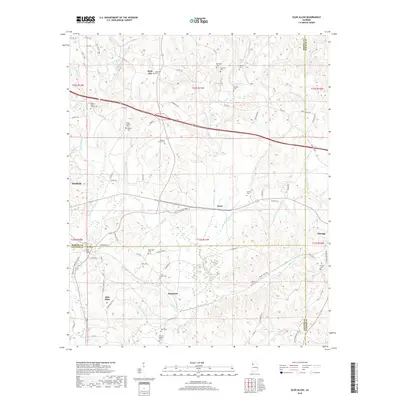
2018 Map of Glen Allen
USGS Topo · Published 2018About this map
Winfield and the neighboring community of Glen Allen sit at the intersection of Marion, Fayette, and Walker counties in this detailed study of Alabama's coal region terrain. The landscape is defined by the winding course of the Sipsey River and the New River, with numerous small tributaries like Mallards Cr and Turkey Cr carving through the landscape. The map provides a remarkable level of detail for genealogists, documenting a high density of rural cemeteries and family burial grounds such as the Walker Baccus Family Cem, Box Cem, and O'Mary Cem.
Find a feature on this map
93 named features on this map. Tap any name to fly to it.
Don’t see what you’re looking for? This feature index may not catch every label — zoom into the map to look around manually.
Map Details
Editions of this 2018 Glen Allen Map
This is the sole edition of this map. No revisions or reprints were ever made.
Other maps of this area

1953 · Birmingham
USGS Topo · 1:250,000

1956 · Birmingham
USGS Topo · 1:250,000

1956 · Gadsden
USGS Topo · 1:250,000

1957 · Birmingham
USGS Topo · 1:250,000

1958 · Gadsden
USGS Topo · 1:250,000

1958 · Gold Mine
USGS Topo · 1:24,000
1958 · Lynn
USGS Topo · 1:24,000

1960 · Gadsden
USGS Topo · 1:250,000

1963 · Gadsden
USGS Topo · 1:250,000

1967 · Winfield SE
USGS Topo · 1:24,000