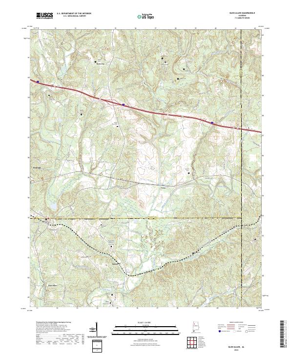
2024 Map of Glen Allen
USGS Topo · Published 2024About this map
The Sipsey River and New River define the undulating landscape of this border region where Fayette, Marion, and Walker counties meet. The settlement of Glen Allen serves as a primary hub in the south, while the northern reaches include the community of Rock City and the historic Walker Baccus Family Cemetery. This contemporary survey illustrates a persistent rural character where small crossroads like Bazemore and Texas are connected by a web of local routes including Old Glen Allen Rd and Old Hwy 78. Genealogists will find a significant concentration of burial sites, ranging from church-affiliated grounds like Whites Chapel Cem and Piney Grove Church of Christ Cem to smaller family plots, providing a clear record of the area's ancestral footprint across the creek-fed valleys of Mallards Creek and Turkey Creek.
Find a feature on this map
88 named features on this map. Tap any name to fly to it.
Don’t see what you’re looking for? This feature index may not catch every label — zoom into the map to look around manually.
Map Details
Editions of this 2024 Glen Allen Map
This is the sole edition of this map. No revisions or reprints were ever made.
Other maps of this area

1953 · Birmingham
USGS Topo · 1:250,000

1956 · Birmingham
USGS Topo · 1:250,000

1956 · Gadsden
USGS Topo · 1:250,000

1957 · Birmingham
USGS Topo · 1:250,000

1958 · Gadsden
USGS Topo · 1:250,000

1958 · Gold Mine
USGS Topo · 1:24,000
1958 · Lynn
USGS Topo · 1:24,000

1960 · Gadsden
USGS Topo · 1:250,000

1963 · Gadsden
USGS Topo · 1:250,000

1967 · Winfield SE
USGS Topo · 1:24,000