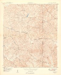
1949 Map of Glen Alta
USGS Topo · Published 1949About this map
Fort Benning Military Reservation dominates the western portion of this landscape, established as a major infantry training center decades before this 1940s survey. The terrain is defined by the winding paths of Ochillee Creek and Hitchitee Creek, which cut through a series of prominent elevations like Bush Hill and Gobblers Hill. Outside the reservation boundary, the map documents small rural junctions such as Christopher and Ida Vesper, which sit along the Central of Georgia rail line.
Find a feature on this map
22 named features on this map. Tap any name to fly to it.
Don’t see what you’re looking for? This feature index may not catch every label — zoom into the map to look around manually.
Map Details
Editions of this 1949 Glen Alta Map
2 editions found
Other maps of this area

1908 · Columbus
USGS Topo · 1:62,500

1929 · Columbus
USGS Topo · 1:48,000

1947 · Columbus
USGS Topo · 1:62,500

1949 · Glen Alta
USGS Topo · 1:24,000

1949 · Ochillee
USGS Topo · 1:24,000

1949 · Buena Vista NW
USGS Topo · 1:24,000

1949 · Cusseta
USGS Topo · 1:24,000

1950 · Louvale
USGS Topo · 1:24,000

1950 · Buena Vista NE
USGS Topo · 1:24,000

1950 · Buena Vista
USGS Topo · 1:24,000