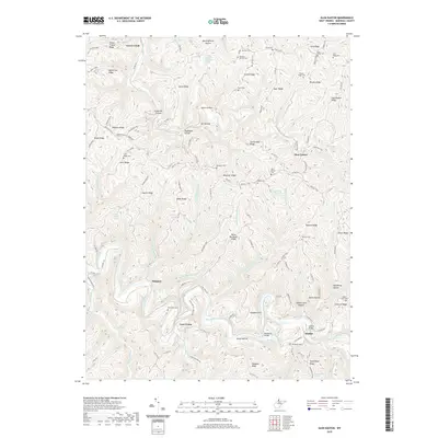
2019 Map of Glen Easton
USGS Topo · Published 2019About this map
Glen Easton and the surrounding Marshall County ridges are defined by a complex network of narrow hollows and deep creek valleys. In the southern portion of the sheet, Fish Creek winds past the settlements of Meighen, Lynn Camp, and Adaline, where the Adaline Bridge and Shephards Bridge facilitate local travel. The landscape is heavily marked by family and community history, evidenced by the numerous burial sites along the high ground, such as Rulong-Bartlett Cem, Richmond Cem, and New Bethel Cem. Paths like the Warrior Trail trace the crests of Bowman Ridge and Roberts Ridge, following the natural contours of the land above Grave Creek. The presence of many springs, including William Standiford Spring and Paul Adams Spring, suggests a rural reliance on local groundwater sources tucked into the base of features like Meetinghouse Hollow and Speakeasy Hollow.
Find a feature on this map
77 named features on this map. Tap any name to fly to it.
Don’t see what you’re looking for? This feature index may not catch every label — zoom into the map to look around manually.
Map Details
Editions of this 2019 Glen Easton Map
This is the sole edition of this map. No revisions or reprints were ever made.
Other maps of this area

1903 · Littleton
USGS Topo · 1:62,500

1904 · Cameron
USGS Topo · 1:62,500

1905 · Littleton
USGS Topo · 1:62,500

1905 · Clarington
USGS Topo · 1:62,500

1906 · New Martinsville
USGS Topo · 1:62,500

1924 · New Martinsville
USGS Topo · 1:62,500

1924 · Littleton
USGS Topo · 1:62,500

1926 · Littleton
USGS Topo · 1:62,500

1926 · New Martinsville
USGS Topo · 1:62,500

1935 · Cameron
USGS Topo · 1:62,500