
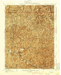
1926 Map of Littleton
USGS Topo · Published 1926About this map
Fishing Creek and the North Fork Pennsylvania Creek define the rugged topography of Wetzel County and the surrounding tri-state borderlands in the mid-1920s. This survey, revised by E.I. Ireland, illustrates a landscape where life revolved around a dense network of mountain ridge schools and valley-floor settlements. Larger centers like Littleton, Pine Grove, and Smithfield appear alongside dozens of isolated rural institutions such as the Dewey School, Green Valley School, and the Mt Morris Church. The map captures the complex interaction between the steep terrain and human development, showing how roads and settlements follow narrow runs like Franklin Fork and Sugar Run. From the German Catholic community of Saint Joseph to the cross-border community of Board Tree, the map documents a distinct Appalachian social geography of rural schools and chapels serving a dispersed population before the major road improvements of the mid-twentieth century.
Find a feature on this map
176 named features on this map. Tap any name to fly to it.
Don’t see what you’re looking for? This feature index may not catch every label — zoom into the map to look around manually.
Map Details
Editions of this 1926 Littleton Map
2 editions found
Other maps of this area

1902 · Clarksburg
USGS Topo · 1:62,500

1903 · Littleton
USGS Topo · 1:62,500

1904 · Cameron
USGS Topo · 1:62,500

1905 · Mannington
USGS Topo · 1:62,500

1905 · Rogersville
USGS Topo · 1:62,500

1905 · Centerpoint
USGS Topo · 1:62,500

1905 · West Union
USGS Topo · 1:62,500

1905 · Littleton
USGS Topo · 1:62,500

1905 · Clarington
USGS Topo · 1:62,500

1906 · New Martinsville
USGS Topo · 1:62,500