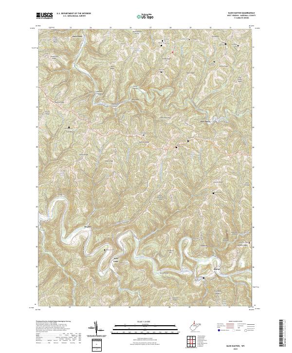
2023 Map of Glen Easton
USGS Topo · Published 2023About this map
Glen Easton serves as a focal point for this section of Marshall County, situated where Grave Creek meets the highlands of the northern panhandle. The landscape is defined by its dendritic drainage patterns, with settlements like Adaline and Lynn Camp nestled in the narrow valleys of Fish Creek and Lynn Camp Run. The map reveal a deeply dissected plateau, where prominent features like Sallys Backbone Ridge and Roberts Ridge separate numerous hollows.
Find a feature on this map
109 named features on this map. Tap any name to fly to it.
Don’t see what you’re looking for? This feature index may not catch every label — zoom into the map to look around manually.
Map Details
Editions of this 2023 Glen Easton Map
This is the sole edition of this map. No revisions or reprints were ever made.
Other maps of this area

1903 · Littleton
USGS Topo · 1:62,500

1904 · Cameron
USGS Topo · 1:62,500

1905 · Littleton
USGS Topo · 1:62,500

1905 · Clarington
USGS Topo · 1:62,500

1906 · New Martinsville
USGS Topo · 1:62,500

1924 · New Martinsville
USGS Topo · 1:62,500

1924 · Littleton
USGS Topo · 1:62,500

1926 · Littleton
USGS Topo · 1:62,500

1926 · New Martinsville
USGS Topo · 1:62,500

1935 · Cameron
USGS Topo · 1:62,500