
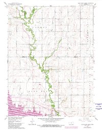
1962 Map of Glen Elder North
USGS Topo · Published 1963About this map
Glen Elder and the surrounding township of Athens anchor this northern Kansas survey, conducted as part of the Department of the Interior program for the Missouri River Basin. The landscape is defined by the winding course of Limestone Creek, which flows southeast past the northern edge of Glen Elder to meet the Missouri Pacific railroad line. This agricultural region is punctuated by local landmarks like the Athens Sch, Athens Cem, and Glenwood Cem, reflecting the distribution of late 19th and early 20th-century rural settlements. The drainage network includes aptly named features such as Disappointment Creek and Spring Branch, while the presence of a Claypit suggests localized extractive industry alongside the area's primary farming base. The map captures the interface between Jewell and Mitchell counties, documenting the placement of rural roads and farmsteads prior to modern highway developments.
Find a feature on this map
15 named features on this map. Tap any name to fly to it.
Don’t see what you’re looking for? This feature index may not catch every label — zoom into the map to look around manually.
Map Details
Editions of this 1962 Glen Elder North Map
2 editions found
Other maps of this area

1894 · Mankato
USGS Topo · 1:125,000

1894 · Beloit
USGS Topo · 1:125,000

1953 · Solomon Rapids
USGS Topo · 1:24,000

1953 · Waconda Springs
USGS Topo · 1:24,000

1953 · Glen Elder South
USGS Topo · 1:24,000

1955 · Beloit
USGS Topo · 1:250,000

1959 · Beloit
USGS Topo · 1:250,000

1962 · Cawker City
USGS Topo · 1:24,000

1962 · Jewell SW
USGS Topo · 1:24,000
1969 · Ionia
USGS Topo · 1:24,000